International Institution for the History of Surveying
and Measurement
A Permanent Institution within the International Federation of
Surveyors (FIG)
|
 |
Paying Tribute to the Struve Arc
Hammerfest, Norway, 16-18 June 2006
 |
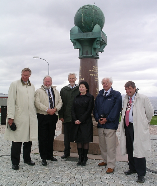
Head of Norwegian Mapping and Cadastre Authority Mr
Knut Flåthen (left), Professor Jan De Graeve, Mr Bjørn
Geirr Harsson, the Norwegian Minister of Fisheries and Costal
Affairs Helga Pedersen, Honorary Secretary Mr Jim Smith,
and the Mayor of Hammerfest Mr Alf E. Jakobsen. |
On the weekend of 16–18th June ten countries in Europe marked the
occasion of 34 triangulation points of surveying importance being accepted
by UNESCO for inscription on the World Heritage List.
These triangulation points form a part of the Struve Arc established
between 1816 and 1852 to measure the size and shape of the globe.
Celebration at the meridian monument
In Norway the official gathering took place at the meridian monument at
Fuglenes in the city of Hammerfest in the county of Finnmark. Professor
Jan De Graeve from Belgium and Honorary Secretary of the International
Institution for the History of Surveying and Measurement, Jim Smith
from England, were guests of honour.
Twelve years ago under the aegis of a Resolution to FIG they initiated
the work of trying to get the Struve Arc on the World Heritage List. The
UNESCO decision is the result of hard work, interest and enthusiasm amongst
the ten countries in Europe urged on by Mr De Graeve and Mr Smith.
The ceremony in Hammerfest was led by the Mayor Alf E. Jakobsen.
Mr Jan De Greave sent regards from UNESCO and the Norwegian Minister of
Fisheries and Costal Affairs, Helga Pedersen, unveiled a plaque in
front of the meridian monument.
Four Norwegian Struve points
For the Norwegian leader, Bjørn Geirr Harsson from the Norwegian
Mapping and Cadastre Authority, this was a very happy day. He had singled
out the four Norwegian triangulation points now being a part of the world
heritage. These are:
- The meridian monument in the authority of Hammerfest
- The mountain peak Lille Raipas in the authority of Alta
- The mountain peak Lodiken (Luvdiidcohkka) in the authority of
Kautokeino
- The mountain peak Bealjasvarri in the authority of Kautokeino
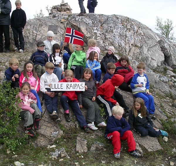
The day before the official gathering at the meridian monument there was
a smaller gathering at the mountain peak Lille Raipas in the authority of
Alta. Many local people joined the 45 minute walk to the top. Here the Mayor
unveiled the UNESCO plaque in front of the cairn.
Spreading consequences
Both in Alta and Hammerfest the value of being a part of the world
heritage is of great importance for the local authorities and population.
Hopefully the four triangulation points of surveying importance will give
extended effects related to tourism and, not least, extend knowledge to the
public about the profession.

Several locals joined the celebration at Lille Raipas in Alta. |
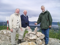
Mr Jan De Graeve (left), Mr Jim Smith and Mr Bjørn Geirr Harsson at the
mountain peak Lille Rapias in Alta. |
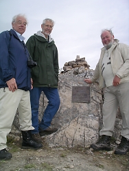
Mr Jim Smith (left), Mr Bjørn Geirr Harsson and Mr Jan De Graeve next to
the UNESCO plaque in front of the cairn on the mountain peak Lille
Raipas. |
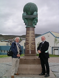
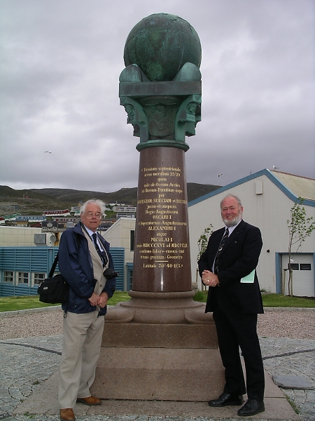
Mr Jim Smith (left) and Mr Jan De Graeve at the monument statue at
Fuglenes in Hammerfest.
|
Hege Sælid, Norwegian Mapping and Cadastre Authority
29 June 2006 |