
Article of the Month - July 2024 |
Peter Bauer, Caroline Schönberger and Werner Lienhart, Austria
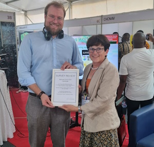
This article was awarded the Survey Review Prize and was presented during the FIG Working Week 2024 in Accra, Ghana.
FIG and Survey Review have decided to award a paper presented at a FIG Congress/Working Week. The Survey Review prize will be awarded every two years to the author and presenter of a selected paper at a FIG Congress/Working Week and will be limited to submissions from authors who fulfil the FIG definition of a Young Surveyor.
Survey Review is an international journal which has been published since 1931, and in recent years under the auspices of the Commonwealth Association of Surveying and Land Economy (CASLE). It has been published continuously as a quarterly journal, bringing together a wide range of papers on research, theory, practice and management in land and engineering surveying.
The paper selected for the prize passes through an initial reviewing and revision stage overseen by FIG, before being judged by members of the Editorial Board of Survey Review.
This year’s winner, “Interactive planning of GNSS monitoring applications with Virtual Reality ” by Peter Bauer, Caroline Schönberger and Werner Lienhart, Austria
 |
 |
Global Navigation Satellite Systems (GNSS) are used in challenging environments with increasing accuracy demands. Therefore, many systematic effects become significant and require a detailed planning of monitoring campaigns with high integrity. In conventional GNSS planning software, the local circumstances at the antenna locations are hardly covered. Due to uniform cut-off angles in the elevation of the satellite orbits the quality investigations are often not representative at inhomogeneous areas (e.g. in the vicinity of mountains or buildings).
In order to fulfil the requirements of modern deformation analysis, the prediction of the satellite visibility and the estimation of the point dilution of precision (DOP) is improved by the usage of high-resolution 3D data. Nowadays, with ray-tracing approaches from the entertainment sector, 3D computations can be easily carried out like in reality based data capture or digital terrain models.
For this purpose, experimental software was developed using Unity software to produce a human computer interface in a Virtual Reality (VR) environment. The VR gear overcomes the limitations of conventional 3D viewers in complex 3D scenarios and provides the user an immersive and interactive first-person view.
The software developed has been tested in a real-life use case for the simulation of GNSS measurements at an Austrian water dam. Furthermore, the predicted results of the simulations have been validated by actual measurements taken at the planned epoch at the site.
The full paper is available to read here.