2018
After more than 20 years of successfully encouraging implementation of
spatial data infrastructure GSDI ‘hand the baton on to others.’
More information
2017
Joint Board of GIS changes name to UN-GGIM-Geospatial Societies
(UN-GGIM-GS).
2016
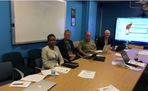
JB-GIS had its official meeting during ISPRS meeting in July
2016. Members of JB-GIS also met at UN-GGIM6 meeting. JB-GIS participated in the UN-GGIM Extended
Bureau meeting on 1
December 2016, New York, USA.
2015
JBGIS Participates at 2015 Meeting of the Committee of
Experts of the UN-GGIM
The 5th meeting of the United Nations Committee of Experts on Global
Geospatial Information Management (UN-GGIM) met at the UN Headquarters in
New York from 5-7 August 2015.
Download meeting document. The
JBGIS made the following remarks to the CoE meeting:
- Take note of the report in E/C.20/2015/15/Add.1, being the report of
the JBGIS to the CoE meeting
- Encourage participation in the International Map Year
- Approve the map exhibition focusing on Sustainable Development Goals
for the 6th UN-GGIM in August 2016
- Include JBGIS members on new Working Groups
- Utilize the expertise of the JBGIS in organising the 4th High Level
Forum, scheduled for Addis Ababa, Ethiopia, Mid-April 2016
2014
Supports 3rd High Level Forum of the UN-GGIM
Several representatives of JBGIS made presentations at the 3rd HLF of the
United Nations Committee of Experts on Global Geospatial Information
Management (UN-GGIM), 22-24 October 2014, held in Beijing, China. In
particular:
- Mark Cygan (IMIA), spoke on behalf of the JBGIS during the Opening
Ceremony
- Teo Chee Hai (FIG), moderated the session “Sustainable Cities and
Human Settlements”
- Abbas Rajabifard (GSDI), gave keynote address in the session
“Climate Change and Disaster Mitigation”
- Mark Cygan (IMIA), member of panel on “Leveraging the
Technology Revolution”
- Chen Jun (ISPRS), gave keynote address in the session “Working
Together Across Borders and Regions”
- Robert Ward (IHO), member of panel on “Working Together Across
Borders and Regions”
Report of HLF
Beijing Declaration
The 4th meeting of the United Nations Committee of Experts on
Global Geospatial Information Management (UN-GGIM) met at the UN
Headquarters in New York from 6-8 August 2014. One of the first items on the
agenda endorsed by the JBGIS, and the Committee of Experts, was a draft
Resolution on the Global Geodetic Reference Frame (GGRF). This was presented
to the UN General Assembly on 26 February 2015.
Report of GGRF resolution
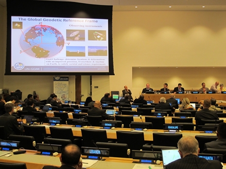
Attendees at the
meeting of the Committee of Experts of the UN-GGIM listening to a
presentation from the GGRF Working Group chair, Mr Gary Johnson (Australia)
2013
|
O. Altan and R. Backhaus |
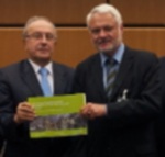
On 3 September 2013, Joint Board of
Geospatial Information Societies (JBGIS), International
Council for Science (ICSU) - GeoUnions, and United
Nations Office for Outer Space Affairs (UNOOSA)
presented a new report in Vienna, Austria, which shows
the economic, humanitarian and organisational benefits
of applying Geoinformation to disaster management. This
report was edited by a team headed Orhan Altan
and Robert Backhaus. The publication aims to
raise awareness and to help set priorities in research
and development. FIG as a member of JBGIS was
represented by Gert Steinkellner, the president
of the Austrian FIG-member organisation. |
 Download publication
(9MB)
Download publication
(9MB)
Download
without login for the full 30MB version
Annual Meeting of the Joint Board of Geospatial Information
Societies
31 August 2013, Potsdam, Germany
The International Association of Geodesy (IAG) hosted the
2013 meeting of the Joint Board of Geospatial Information Societies (JBGIS)
in Potsdam at the DeutschesGeoForschungs-Zentrum GFZ.
Exchange Forum : Future Proofing the Provision of
Geoinformation : Emerging Technologies, with the international geospatial
industry, Doha, Qatar, 3 February 2013
An Exchange Forum with the Geospatial Industry was
developed and facilitated as a collaborative effort, developed and moderated
by members of the organisations that comprise JBGIS and facilitated by the
UN Cartographic Section, Strategic Support Service, Department of Field
Support, with support from the UN Statistics Division. Colleagues from the
international industry, government, research and education geospatial
community also generously supported the Exchange.
It was held at the Qatar National Convention Centre, Doha, Qatar on the day
immediately before the Second High Level Forum on GGIM, on Sunday February
3, 2013. The Exchange was entitled: Future Proofing the Provision of
Geoinformation: Emerging Technologies. This pre-conference exchange
facilitated the continued involvement of the geospatial industry at the most
senior levels in the discussions surrounding UN-GGIM. It serves as a means
for the industry to ‘tie’ into the GGIM agenda, while demonstrating some of
the trends and directions in which the industry is heading.
Four focus issues were addressed during the Exchange: Determining place,
Monitoring place, Connecting place and Delivering [geoinformation about]
place. Below are summaries of the focus of each session and the outcomes.
-
Determining place
The session addressed the methods and technologies used to determine
place. Advances in geodetic reference frames and techniques, surveying
methods and technologies and the overarching concepts of geographic
information collection and classification were the themes of this focus
session. The session covered how new technologies can be used to
facilitate the efficient location of geographic information – from
global to local applications.
Summary of the outcomes of this session:
IAG has developed an accurate International Terrestrial Reference System
(ITRS) on which all GNSS positioning services are based. The
sustainability of ITRS implementation and associated infrastructures
require intergovernmental support and commitment through a UN mandate.
-
Monitoring place
Advances in remote sensing and imaging, and related technologies
continue to make data collection, monitoring and surveillance more
efficient. This is happening from local to global applications. This
session provided discourse on technologies; strategies and methodologies
that facilitate essential information capture to support global
geospatial initiatives.
Summary of the outcomes of this session:
Noting the advances in number, types and capacities of platform and
sensors, imageries is the main source of data and the basis for
monitoring place. There remain the needs for open standards and
strategies to demonstrate the underlying economic benefit of geospatial
information as well as consideration to address privacy issues that are
context driven. These are important considerations for the future
technological development.
-
Connecting place
Facilitating the accessibility and usefulness of geolocated data and
collected information relies upon having systems and agreements in place
that enable the efficient use of these resources. At a global level,
just having information available is not enough – efficient and usable
methods for management, access and dissemination are needed. This
session covered the advances in research and development and current
initiatives being applied to ensure that decision-makers are able to
better access and use geospatial data and information.
Summary of the outcomes of this session:
Collaborating and communicating across disciplines using the value
of place to facilitate informed decision making to improve societies.
This could be achieved by integrating authoritative and crowd-sourced
information and place-based analysis using the Cloud platform.
-
Delivering [geoinformation about] place
Once geospatial data and information is collected, analysed and
represented there exists the need to have systems and standards in place
to ensure efficient delivery of that data and information. Rapid
advances are being made in this area, as electronic production and
publishing methods are combined with contemporary communications systems
for output and delivery. This session provided information regarding
current and developing technologies for production and delivery of
authoritative data and information for decision-makers.
Summary of the outcomes of this session:
Contemporary GIS offers flexible platforms for managing and
integrating data under the context of location. Electronic production
and publishing methods are combined with contemporary communications
systems for output and delivery. There remain the needs for effective
communication of geospatial information through context-dependent
contemporary cartographic presentation techniques to ensure efficient
2012
Annual Meeting of the Joint Board of Geospatial Information
Societies
26 August 2012, Melbourne, Australia
The International Society for Photogrammetry and Remote
Sensing (ISPRS) hosted the 2012 edition of the meeting of the Joint
Board of Geospatial Information Societies (JBGIS) at its XXII Congress
in Melbourne, Australia on 26 August 2012.
Report from
the meeting
2010
JB-GIS Best Practices Booklet on Geoinformation for Disaster
and Risk Management, Examples and Best Practices
2 July 2010, a press conference and book launch by the Joint Board of
Geospatial Information Societies (JB GIS) and the United Nations Office
of Outer Space Affairs (UNOOSA) at the UNOOSA office in Vienna, Austria,
released the booklet they jointly produced titled Geoinformation for
Disaster and Risk Management, Examples and Best Practices.
Download booklet
24 July 2010
|